Summary
In high-pressure disaster scenarios, fragmented communication costs lives. I led the end-to-end UX strategy and interface design for the Emergency Management Information System (EMIS), a geospatial platform that unified 5+ government departments to streamline disaster response for the city of Dar es Salaam.
The Challenge: Bridging a Multi-Agency Information Gap
Emergency responders suffered from a lack of timely, coordinated communication. There was no centralized inventory of events or resource tracking, leading to delayed, ineffective response activities.
The Goal: Transform a fragmented, paper-based workflow into a real-time, geospatial command center.
“We exhaust a lot of resources in the event of emergency. Better data, equipment, and coordination is needed to support our greatest asset: people.”
Dar es salaam Regional Response Team Coordinator
Strategy & Stakeholder Alignment
Managing this project required navigating complex organisational hierarchies. I moved beyond simple research to Strategic Alignment
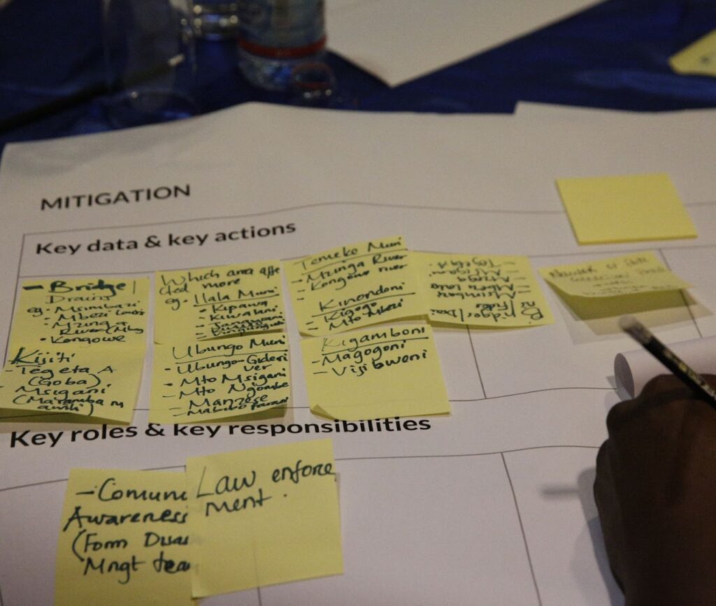
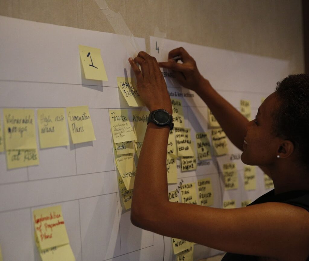
- Discovery at Scale: Coordinated and led discovery workshops for 120+ stakeholders across 4 Local Government Authorities (LGAs).
- Methodology: Utilized stakeholder interviews and discovery field visits to map the “Information Life Cycle”—identifying exactly where data was getting stuck between command center and field responders.
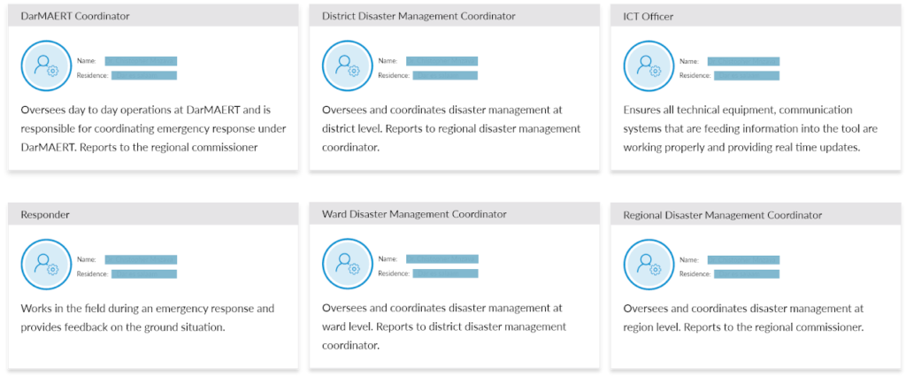
- Role-Based Architecture: Instead of generic personas, I developed Role-Based Personas focused on organisational functions, ensuring the UI adapted to the specific permissions and needs of different command levels.
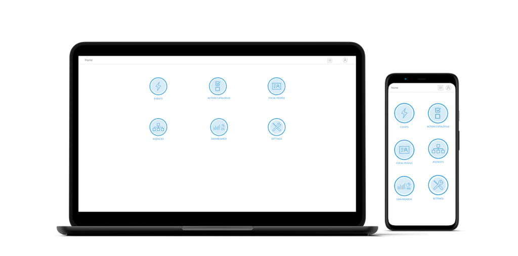
The Solution: A Geospatial Ecosystem
I facilitated the transition of the system from a database to a Command & Control hub by aligning technical constraints with stakeholder needs to create a unified dashboard experience.
- Feature Prioritization: Led the squad to prioritize a “Single Source of Truth” personnel database, followed by real-time emergency alerts and digital response plans.
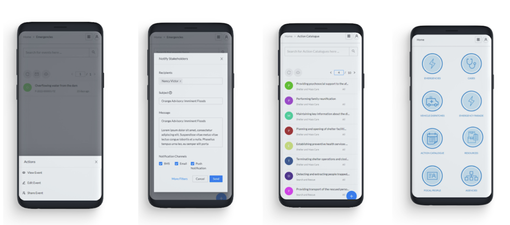
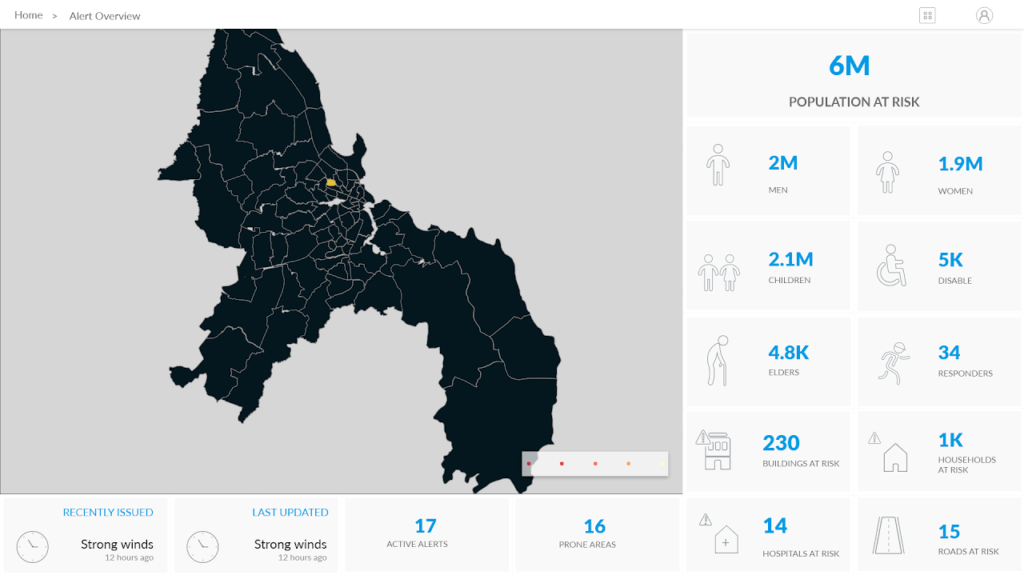
- Geospatial Intelligence: Integrated map visualizations across all modules to provide immediate spatial context for resource allocation (warehouses, personnel, and event locations).
- Responsive Resilience: Designed for “Field to Office” continuity. Since responders are mobile, I led a Mobile-First redesign of key features to ensure usability in high-stress, on-the-go environments.
Validation & Iterative Evolution
- Usability Guardrails: Conducted moderated testing at the Emergency Operations Center (EOC). By allowing users to compare the prototype against live workflows, we identified the need for a total layout overhaul to improve navigation speed.
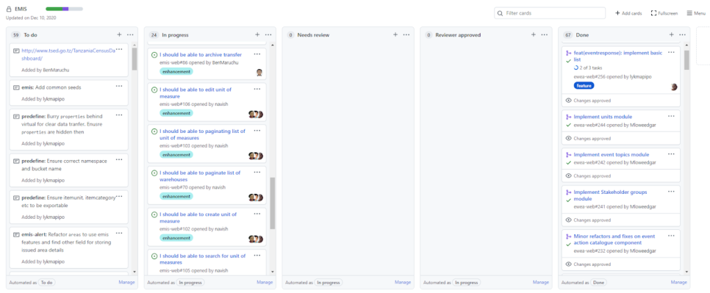
- Systems Thinking: In close collaboration with the developers, I led the creation of reusable interface components. This foresight allowed the system to be rapidly customised in 2020 to track COVID-19 cases, demonstrating the platform’s long-term scalability and ROI.
Impact & Legacy
- Adoption: The EOC adopted the platform as its operational standard for drills and live response activities, providing a scalable framework that continues to guide the development of the regional emergency command centre.
“Proper use of data and information obtained from Emergency Management and Information System (EMIS) has improved emergency response and inform the regional authority the priorities during emergency planning. ”
Dar es salaam Regional Response Team Coordinator
Visual Strategy: Establishing a Trustworthy Identity
The visual layer was designed to establish authority and clarity in critical environments. The goal was to create a cohesive design language that built user confidence and reduced cognitive load.
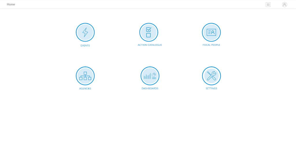
- Cohesive Branding & Iconography: The project included a custom-designed visual identity and icon set specifically tailored for emergency contexts. This ensured that critical actions and geospatial markers were instantly recognizable, even under the high-stress conditions faced by responders.
- Intentional Empty States: I designed empty states as active onboarding touchpoints. These interfaces provided clear guidance, system status and calls to action, ensuring users understood what was going on in the system and what actions they need to take in response to their workflows from their first login.
- Design for Accessibility and Trust: A selection of typography and colour palettes balanced the need for urgency with high legibility. This visual framework ensured the platform felt like a reliable, professional tool for both government leadership and field-level personnel.
Project Details
Platform: Web (Desktop & Mobile)
Scale: City-wide (Dar es Salaam), 5+ million residents
Impact: 120+ High-level Stakeholders
Timeline: 2018 – 2022
My Role
- Strategy: Stakeholder Alignment, Workshop Facilitation, Feature Prioritisation.
- Research: User Research, Persona Development, Usability Testing (Moderated/Unmoderated).
- Design: UI/UX Design, Brand Identity, Custom Iconography, System Illustrations, Prototyping.
- Technical: Front-End Collaboration, Design System Governance.